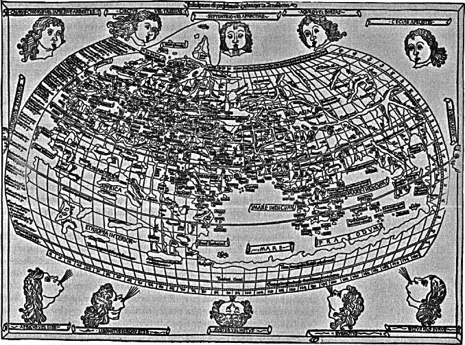
The rediscovery of Ptolemy's Geography in the early fifteenth century reintroduced the notion of charting land masses on a grid. Here depicted is a printed map based on Ptolemy. Notice also the figures of the winds about the page. These recall the ancient classifications of winds. The discovery of wind systems was as important to new navigational feats as new methods of mapping.