Friday February 20, 2026
Outdoor Action Mt. Princeton Climb Map
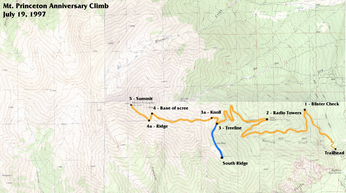
This is a GIF version of the the four USGS maps that cover Mt. Princeton showing the 1997 route. this is the same route which we will use for the 1999 climb. The maps have been "stitched" together in an image editing program to provide one image. You will need to scroll to the right to see the rest of the map. You can also download the map GIF file.
The orange line marks the main route to the summit. The blue line shows a side route on the south ridge out towards Lucky Mine. This route is one of the options for families with young children. The view from the end of the ridge is striking. Points 1, 2, 3, 3a, 4, 4a, and 5 are the checkpoints along the hike.